Underground services locating

Underground service locating support for WA projects

Underground service locating and survey support for civil, construction and infrastructure works across WA. Noble Surveys helps project teams review available records, locate detectable services, mark and survey service positions, and prepare practical records for excavation planning, design and construction review.

Record review

DBYD + site records

Available plans and site information reviewed before field locating begins.

Detection methods

GPR + EM

Locating methods selected to suit service type, site conditions and project requirements.

Usable records

Mark + survey

Located services can be marked, surveyed and documented for project teams.

Risk management

Verify where needed

Physical verification may be required where certainty is needed before excavation.

Mark-outs, plans and survey records help project teams understand known and detectable underground services before excavation, design or construction decisions are made.

Utility mark-out

Locating detectable services

GPR and electromagnetic locating can help identify detectable drainage, sewer, water, power and communications services before excavation and design decisions are made.

As-built capture

Survey capture of located services

Survey capture records the detected service positions, depths and alignments so project teams can reference the results in CAD, GIS or construction workflows.

Design coordination

Planning and coordination support

Located service information can be issued for design coordination, clash checking and excavation planning alongside DBYD data and site verification requirements.

How this helps on site

How this service helps on site

Operational examples showing how Noble Surveys supports WA teams on similar scopes.

Scenario

Service locating support before excavation and design decisions

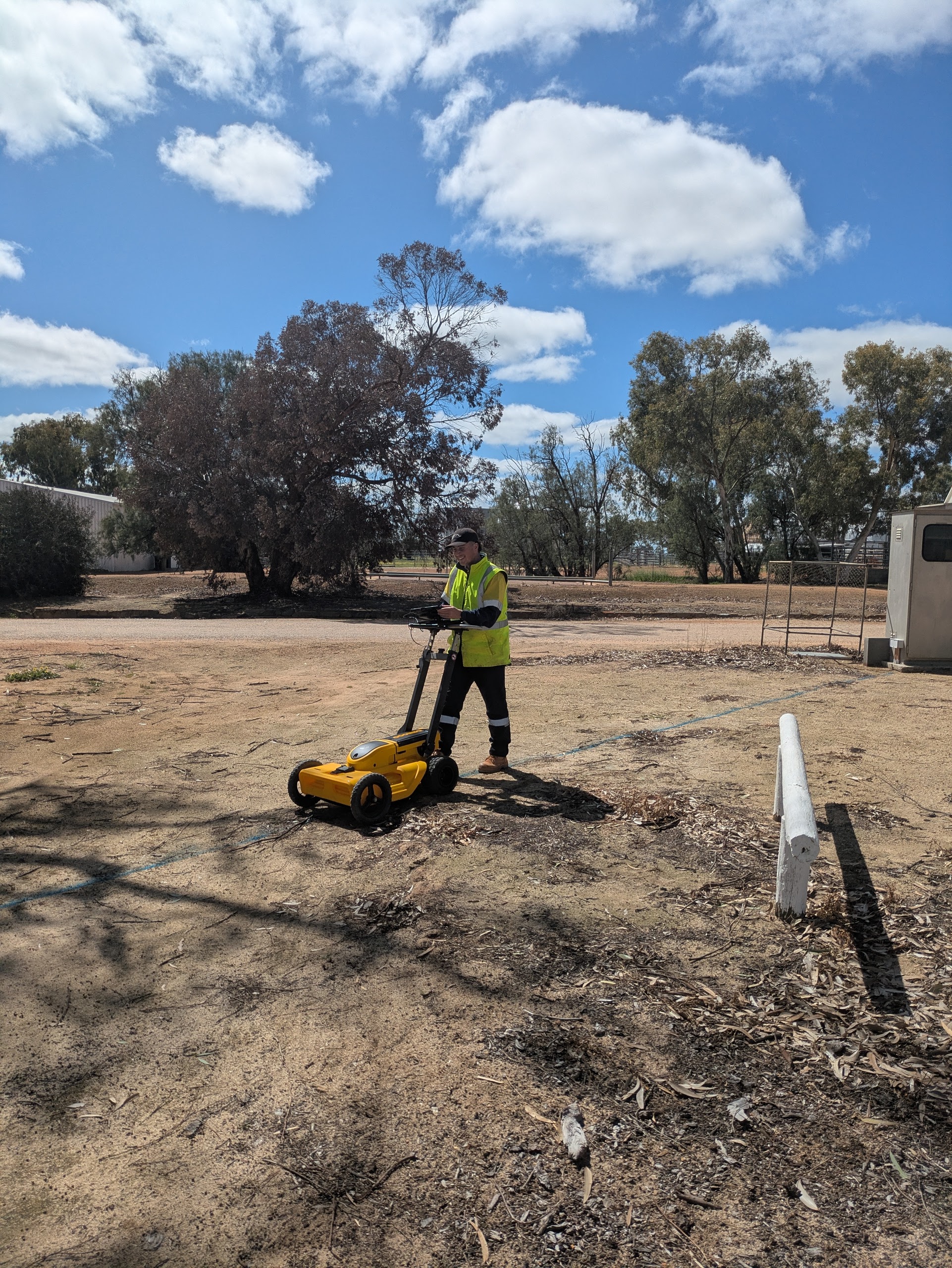
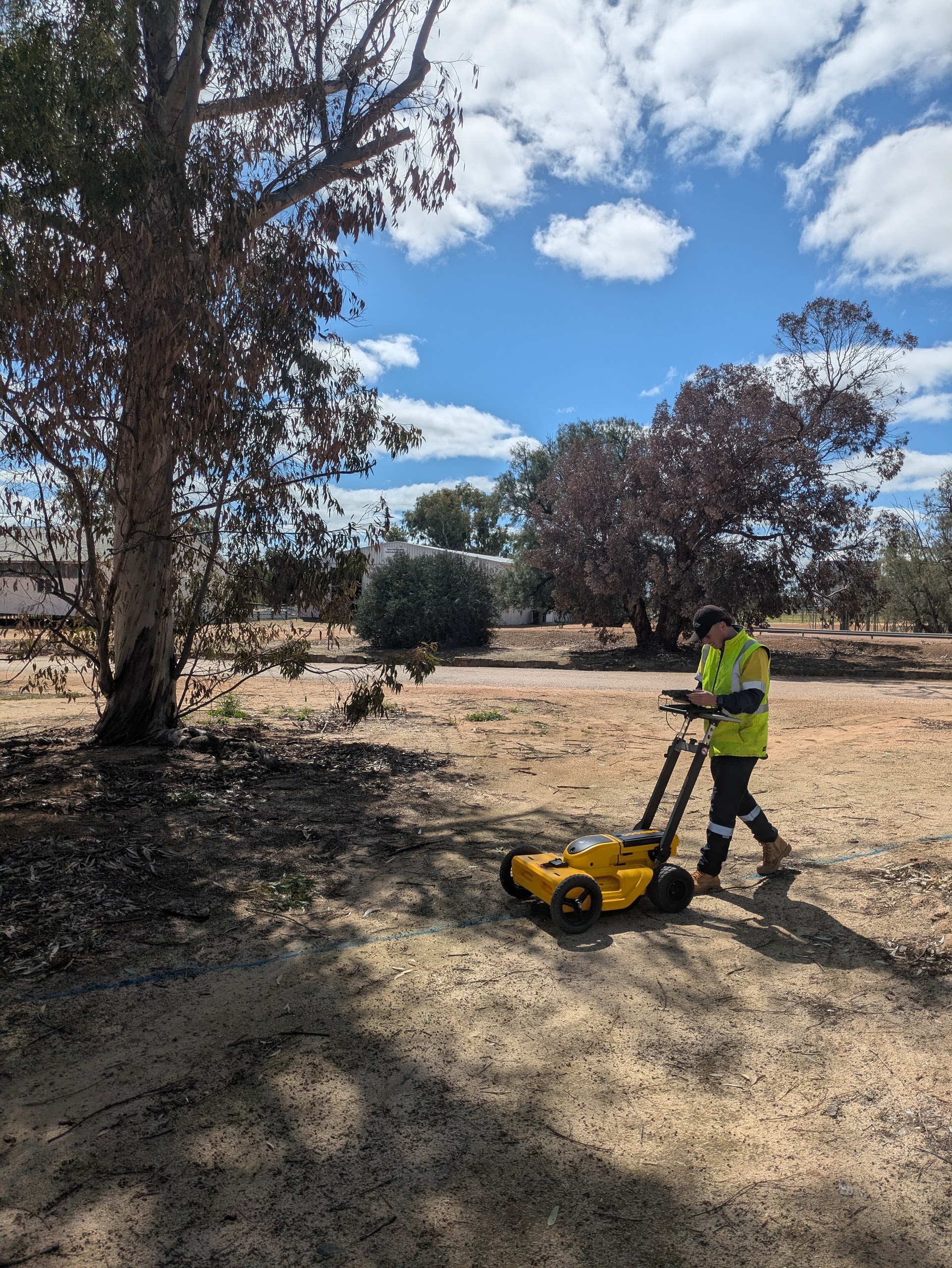
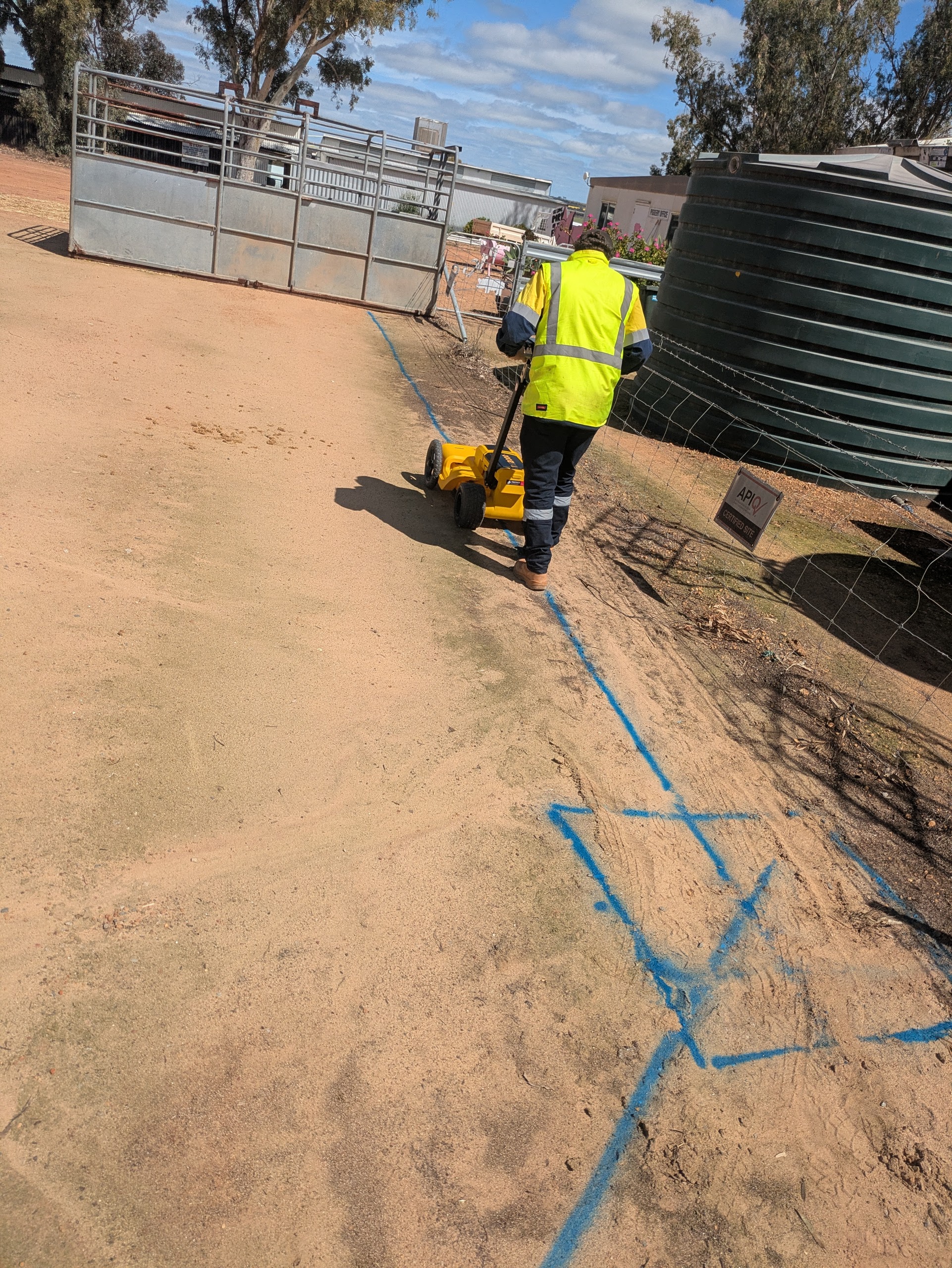
Civil and construction projects need a clearer picture of known and detectable underground services before excavation, design changes or service relocations proceed.

Noble Surveys approach

Noble Surveys supports project teams by reviewing records, using suitable locating methods, marking and surveying located services, and preparing practical records for excavation planning and project review.

Deliverables issued

  • DBYD and supplied-plan review notes
  • Service mark-outs where detectable
  • Surveyed service positions where required
  • PDF markups, DWG/DXF drawings or GIS-ready records
  • Limitations and verification notes for project review

Outcome / risk reduced

Project teams receive clearer records of known and detectable services, helping them plan excavation, design and construction works with better information.

construction-surveysengineering-surveysas-built-surveysinfrastructure-surveys
Need the same outcome? Start a conversation.

Service locating support your project team can use

Record and scope review

Review DBYD responses, supplied plans and site information so locating works start with the best available records and clearly understood limitations.

  • DBYD, utility and project plans collated
  • Assumptions and gaps noted before fieldwork
  • Helps align locating scope with project needs

EM and GPR locating

Use electromagnetic and ground-penetrating radar methods where suitable to help identify detectable underground services subject to site conditions and service types.

  • Methods selected per service material and depth
  • Results documented with limitations
  • Supports excavation and design planning

Mark-outs and survey capture

Located services can be marked on site and surveyed so designers, supervisors and constructors can reference the positions in CAD, GIS or construction workflows.

  • On-site mark-outs where access allows
  • Survey pickup of located services
  • DWG/DXF, strings or GIS-ready data prepared

Verification and reporting

Limitations, verification requirements and recommended potholing or non-destructive digging are documented so teams understand how results should be used alongside other controls.

  • Service location reports with context
  • Notes on where potholing may be required
  • Files issued for project or asset-owner review

How we support underground service locating

Service locating is planned around available records, site access, service type, ground conditions and the level of certainty required before design or excavation.

Records and scope review

Review

Scope and limitations confirmed before fieldwork.

We review DBYD information, supplied plans, site records, project scope, access constraints and required outputs before field locating begins.

Field locating and mark-out

Locating

Results depend on service material, depth, congestion and site conditions.

We use suitable locating methods such as EM and GPR where appropriate to help identify detectable services, then mark and record service positions for project use.

Survey records and verification

Records

Records support planning but do not replace physical verification where required.

Located services can be surveyed and documented for design or construction review. Physical verification such as potholing or non-destructive digging may be required where certainty is needed.

What you receive

What you receive

Submission-ready files, QA logs and commentary so your team can act immediately.

Service location records

Records
  • Marked service locations on site where detectable
  • Survey pickup of located services where required
  • DWG/DXF drawings and survey strings
  • GIS-ready service data where required
  • PDF markups or service sketches

Risk and verification support

Support
  • DBYD and supplied-plan review notes
  • Service location reports with limitations
  • GPR/EM locating notes where applicable
  • Potholing or non-destructive digging coordination notes where required
  • QA notes and supporting documentation for project review

Ways we can support your project

Ways we can support your project

From rapid one-off validations to embedded project teams, choose the coverage that fits your workload.

Pre-excavation locating

For civil works, service trenches, roadworks and construction sites.

Locating
  • DBYD and supplied-plan review
  • EM/GPR locating where suitable
  • Mark-out and survey records where required

Design and utility mapping support

For projects needing service information before design or relocation works.

  • Survey pickup of located services
  • CAD/GIS-ready outputs where required
  • Limitations and verification notes

Verification support package

For works where physical confirmation is required before excavation.

  • Potholing or NDD coordination notes where required
  • Updated records after verification
  • QA notes for project review

FAQs

Common questions about Underground service locating support for WA projects

Answers to the questions we hear most from WA project teams.

Can you locate all underground services?

No locating method can guarantee every underground service will be detected. Results depend on service material, depth, ground conditions, congestion, access and available records. We use suitable methods to help identify detectable services and document limitations.

Do I still need DBYD?

Yes. DBYD and supplied service plans should be reviewed before field locating. Locating helps compare available records with site conditions, but DBYD information may be incomplete or require further verification.

Can you survey located services?

Yes. Located services can be surveyed and documented in agreed formats such as DWG/DXF drawings, survey strings, GIS-ready files, PDF markups or service sketches where required.

Is potholing still required?

Physical verification such as potholing or non-destructive digging may still be required where certainty is needed before excavation, construction or design decisions.

How quickly can service locating be arranged?

Timing depends on location, scope, site access, crew availability and the information available before fieldwork. Urgent works can be prioritised where practical.

Need survey support for your project?

Speak with Noble Surveys about your scope, site requirements and the survey deliverables you need.

Underground Service Locating WA | GPR & EM Support | Noble Surveys